Real Estate Drone Video Editing
Aerial property footage is the hardest material to integrate into a listing video. We correct horizon drift and lens distortion, colour-match your drone footage to your interior camera, and build the cut so the move from sky to front door feels like one continuous piece of film.
24–48h standard turnaround · 2 revision rounds · 16:9 and 9:16 delivered · Unbranded MLS versions on request
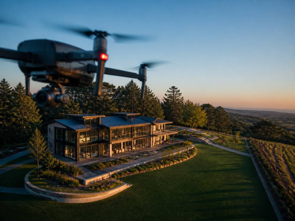
The problem with drone footage in property video
Drone footage almost always looks good on its own and almost always looks wrong next to interior footage. There are four technical reasons for that, and all four are fixable in post.
Different colour science
A DJI sensor and a full-frame mirrorless camera render the same scene differently — particularly in greens, skies and skin tones. Cutting between them untreated produces a visible jump. We match them on scopes before grading.
Horizon drift
On orbits and long lateral moves the horizon rolls slowly. Viewers rarely identify it consciously but it reads as amateur. We correct it across the move rather than at a single keyframe.
Barrel distortion
Wide drone lenses bend straight lines — roof ridges, fence lines, property boundaries. On a property video, where straight lines are the subject, this matters more than it does in landscape work.
Log footage handled wrong
D-Log and D-Cinelike footage graded directly from log tends to produce unstable skin tones on any agent-to-camera segment. We apply the manufacturer LUT first, then grade.
What we do to your aerial footage
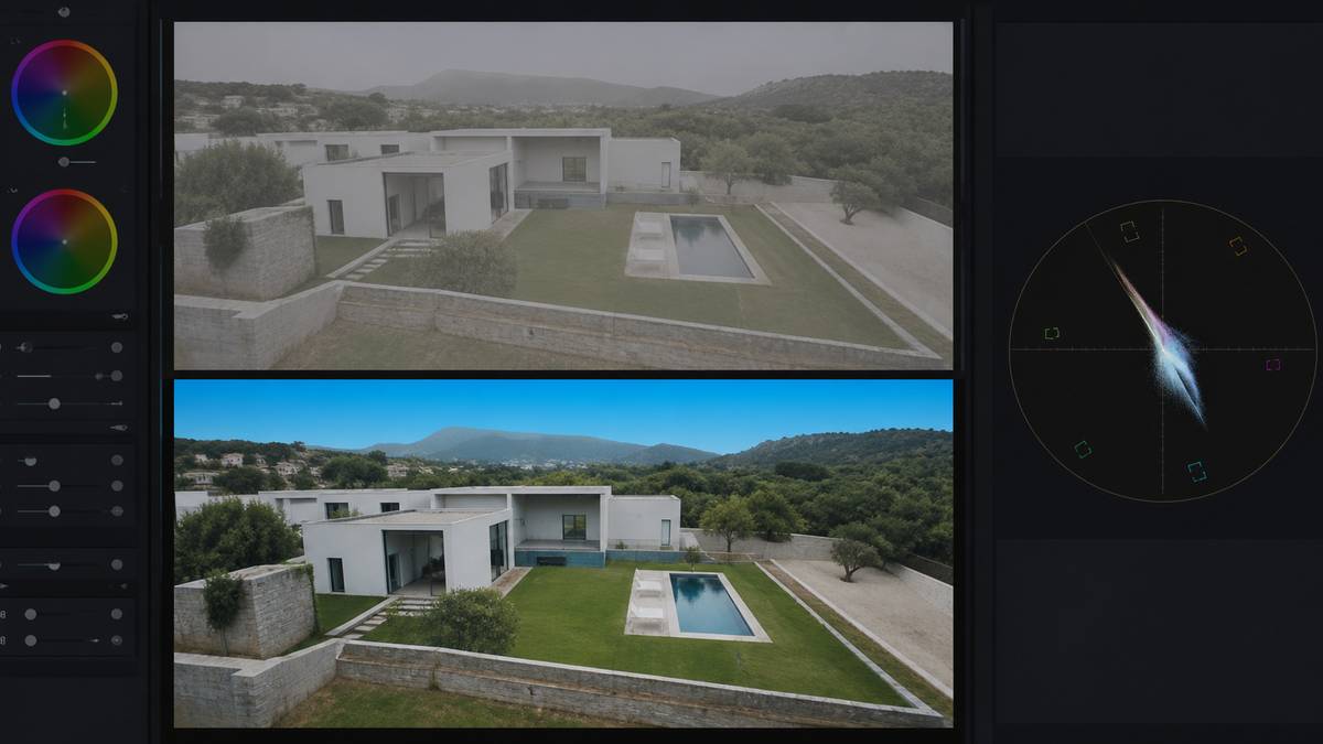
Drone footage arrives, gets corrected, gets matched, then gets cut. In that order.
Correction
- Horizon levelling across the full move
- Lens and barrel distortion correction
- Rolling shutter correction
- Stabilisation of gust-affected clips
- Exposure ramp smoothing on reveals
Grading
- Manufacturer LUT applied to log footage first
- Colour matched to your interior camera
- Sky recovery and gradient control
- Green and foliage correction
- Consistent look across the full timeline
Motion
- Speed ramping on reveals and orbits
- Trimming to the usable portion of each move
- Match cuts between aerial and ground
- Parallax-preserving transitions
Graphics
- Property boundary and lot line overlays
- Site plan and plot outline graphics
- Location and landmark callouts
- Distance-to-amenity annotations
- Acreage and elevation labels
Property boundary and lot line graphics
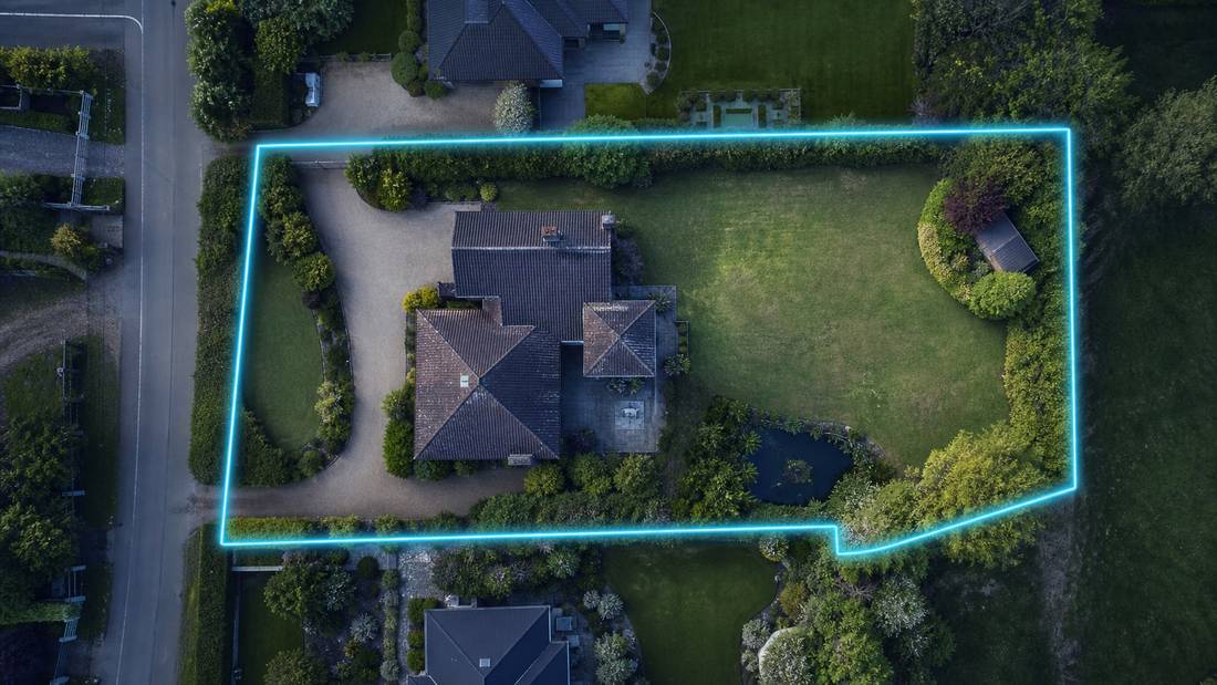
For land, estate and commercial listings, an aerial shot with the property boundary drawn on it answers the buyer’s first question immediately: what exactly am I buying?
We produce animated boundary overlays from a plot plan, survey or parcel map that you supply. We can also add acreage labels, easement markings, access route highlighting and distance callouts to nearby amenities.
We draw boundaries only from a document you supply — a survey, plot plan or parcel map. We do not estimate boundaries from satellite imagery, because an inaccurate boundary line on marketing material is a real liability for the listing agent.
Drone footage we work with
We regularly receive and edit footage from all of the following, in both standard and log profiles.
- DJI Mavic 3, Mavic 3 Pro, Mavic 3 Classic — D-Log and D-Log M
- DJI Air 2S, Air 3, Air 3S — D-Log M and normal
- DJI Mini 3 Pro, Mini 4 Pro — D-Cinelike and normal
- DJI Inspire 2 and Inspire 3 — ProRes and CinemaDNG
- Autel EVO II and EVO Lite series
- Skydio and other autonomous platforms
If your drone is not listed, send a sample clip and we will confirm before you commit to a project.
What we can and cannot fix in post
Being honest about this saves you a reshoot at the wrong time.
We can fix
- Horizon drift and roll
- Lens distortion
- Colour mismatch between cameras
- Mild over- and under-exposure in log
- Minor jitter and gust wobble
- Flat, low-contrast log footage
- Inconsistent white balance between clips
We cannot fix
- Blown-out skies with no recoverable detail
- Footage shot into direct midday sun
- Motion blur from flying too fast
- Out-of-focus clips
- Heavily compressed low-bitrate footage
- Rain, heavy haze or poor visibility
- Missing coverage — we cannot invent a shot
Turnaround times and file delivery
| Service level | Turnaround | Price adjustment |
|---|---|---|
| Standard | 24–48 hours | Base price |
| Rush | 12 hours | +30% |
| Same day | Under 8 hours, subject to capacity | +50% |
| Bulk / retainer | Scheduled capacity slots | Volume discount |
Sending files
- Accepted formats: MP4, MOV, ProRes, H.264, H.265, and DNG sequences
- No file size limit — send via Dropbox, Google Drive, WeTransfer or our upload link
- Send everything you shot. We do the selecting.
Getting files back
- Direct download links, no account required
- Branded and unbranded versions of every cut
- Project files retained for 60 days after delivery
Pricing
| Package | Includes | Price |
|---|---|---|
| Essential Listing Edit | Up to 60 seconds, single format, standard grade, licensed music, 1 revision | $99 |
| Cinematic Property Edit | Up to 120 seconds, 16:9 + 9:16, full grade, sound design, branding, 2 revisions | $179 |
| Luxury & Drone Edit | Up to 180 seconds, drone integration, custom titles, colour matching, 3 revisions | $299 |
| Volume / White Label | Bulk pricing for photographers and brokerages, scheduled capacity, dedicated editor | Custom |
Every package includes both aspect ratios and an unbranded MLS-compliant cut at no extra cost. See full pricing and add-ons.
Frequently asked questions
Can you edit drone footage together with my interior footage?
Yes — this is the main reason people come to this service. We colour-match the two sources, correct the aerial clips, and build the cut so the transition between exterior and interior is seamless rather than jarring.
Do you handle D-Log and D-Cinelike footage?
Yes. We apply the correct manufacturer LUT for your specific drone and profile before grading, rather than grading directly from log, because that produces more predictable and more natural results.
Can you add property boundary lines to aerial shots?
Yes, as an add-on. We need a survey, plot plan or parcel map from you to draw from. We will not estimate a boundary from satellite imagery, because an inaccurate line on marketing material creates liability for you.
Do you edit commercial real estate drone footage?
Yes. Commercial aerial work has different priorities — site access, parking counts, loading areas, proximity to transport links and surrounding tenancy. See our commercial real estate service.
I only have drone footage and no interior clips. Can you still make a video?
Yes. Aerial-only edits work well for land, lots, development sites and exterior-focused commercial listings. They typically run 45 to 75 seconds.
Can you fix footage where the horizon is not level?
Yes, in almost all cases. Horizon correction across a moving shot is standard on every aerial clip we handle and is included in the base price, not charged as an extra.
Send us your aerial footage.
Drone clips, ground footage, or both. We will confirm price and delivery time within 4 business hours.
Technical reference
Colour profiles we handle, by drone
Send footage in whatever profile you shot. We apply the correct manufacturer transform before grading rather than grading from log directly, because grading from log produces unstable skin tones the moment an agent appears on camera.
| Drone | Common profiles | Our treatment |
|---|---|---|
| DJI Mavic 3 / 3 Pro / 3 Classic | D-Log, D-Log M, Normal | Manufacturer LUT first, then creative grade |
| DJI Air 2S / Air 3 / Air 3S | D-Log M, Normal | D-Log M transform, highlight recovery on skies |
| DJI Mini 3 Pro / Mini 4 Pro | D-Cinelike, Normal | D-Cinelike transform, extra noise control in shadows |
| DJI Inspire 2 / 3 | ProRes, CinemaDNG, D-Log | Full grade from RAW or ProRes where supplied |
| Autel EVO II / EVO Lite | Log, Normal | Autel log transform, colour matched to your ground camera |
| Skydio and autonomous platforms | Normal | Corrected and matched; limited grading latitude |
Manufacturer specifications are published by DJI and are worth checking before you buy, particularly the bit depth and colour profile options, which determine how much grading latitude you are giving your editor.
Shooting notes
Before you fly for a listing
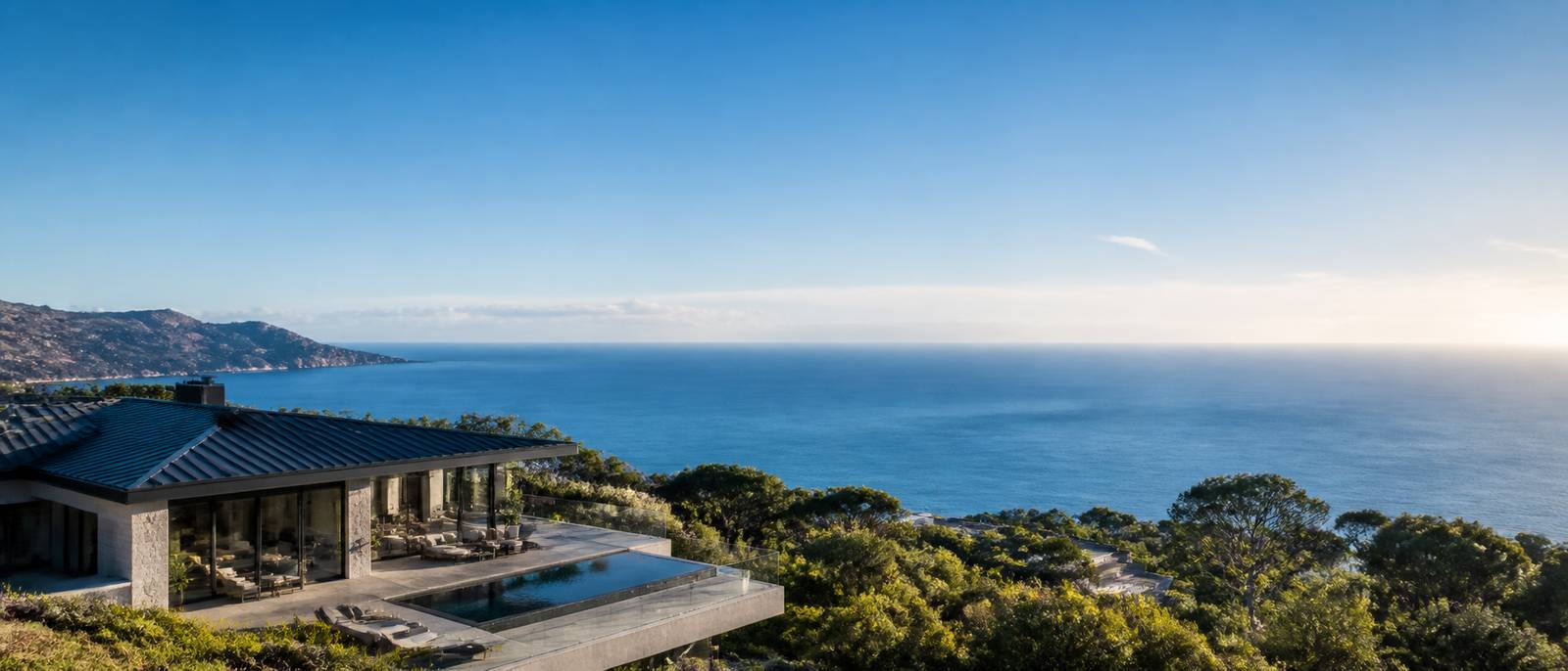
We edit the footage; we do not fly. But most of the aerial problems that arrive in our queue are decisions made in the air, so these are worth knowing.
- Check your legal position first. In the US, filming a listing for payment is commercial operation and falls under FAA Part 107. Other markets have equivalents. This is the agent’s or photographer’s responsibility, not the editor’s.
- Fly slower than feels right. Aerial movement always looks faster on a screen than it did on the controller.
- Shoot the reveal twice, once at normal speed and once slower. You will use the slow one.
- Get a straight top-down. It is the shot that sells land and plots, and it is the one most people forget.
- Keep the horizon level in-camera. Correcting it in post is standard for us but it costs you a small amount of frame on every corrected clip.
- Match your profile to your ground camera where you can, or shoot log on both. Mixed profiles are fixable but they are the slowest part of the job.
- Shoot the boundary if it matters. For land and estate listings, get a wide high frame showing the whole plot so a boundary overlay has something to sit on.
See the full shot list · Read the drone video guide · Commercial property drone work
Sources and further reading
We link out to primary sources rather than to other blogs. Where a figure on this page comes from research we did not conduct, the original study is linked below.
- DJI — Official product specifications — Manufacturer specifications for the drones whose footage we colour-grade, including colour profiles.
- FAA Part 107 — Small Unmanned Aircraft Rule — US requirements for commercial drone operation, which apply to anyone filming a listing for pay.
- Adobe — Working with log footage and LUTs in Premiere Pro — Technical reference for the log-to-Rec.709 workflow described on this page.
- Google Search Central — Video SEO best practices — Google’s own documentation on how video pages are crawled, indexed and shown in search.
Related services
Commercial Real Estate Video
Site context, access and specification overlays for CRE assets.
Specialist real estate video editors. We turn property footage and listing photographs into finished listing videos for agents, photographers and brokerages worldwide.
[email protected]
Replies within 4 business hours
Editing Services
AI Video Maker
Guides & Resources
Serving real estate agents, property photographers and brokerages in the United States, Canada, the United Kingdom, Australia and worldwide. All editing performed by a dedicated real estate video team. We do not shoot on location — everything is remote and digital.
- © 2026 Real Estate Video Editor
- Privacy Policy
- Terms of Service
- Acceptable Use
- Refund Policy
- AI Transparency